

Up 'n' Down t' West Ridin' (perm event)
NB you will be asked for the ride date on the online entry form but this can be amended prior to setting off
or anywhere on route if using eBrevet or GPX
 ⟺Distance: 114 km
AAA points: 2

Peak Audax CTC

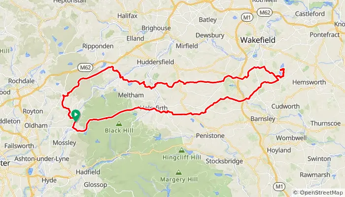
A trip across the West Riding mainly on quiet lanes. Brief route details are as follows: UPPERMILL (Control), Isle of Sky road, Holmfirth, Jackson Bridge, Upper Denby, Kexbrough, Darton, ANGLERS COUNTRY PARK – SQUIRES TEAROOMS (Control), Newmillerdam, West Bretton, Emley Moor, Farnley Tyas, Honley, Blackmoorfoot, SLAITHWAITE (Control), POLE MOOR (Info Control), Denshaw, UPPERMILL (Control).
Start at any point on the route you can get a proof of passage.
Permitted forms of proof of passage are: GPS, E-Brevet, Paper
⟺Distance: 114 km