


That rare type of event; a four hundred km Audax ride in Wales without AAA points! This is a fairly easy ride from Poynton to Holyhead and back. Easy, that is, apart from it being a 250 mile bike ride. The ride counts towards both the PARTY award , and the Peak Audax SR award .
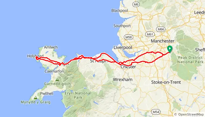
This 400km Perm is a ride across Cheshire and along the North Wales coast to Holyhead and back. Only 2 major climbs are encountered, with the first at 83km onto 263m Halkyn Mountain to avoid the mainly dual carriageway through Mostyn, the second, 158m over Sychnant Pass at 142km to avoid the coast road between Conwy and Pemmaenmawr.
Note that our traditional Poynton car park off Park Lane (near Waitrose) is now Pay and Display (except Sundays). The eBrevet will allow you to register ‘Poynton’ from Poynton Pool car park or Torkington Park car park which both still offer free parking.

One of the cycling bridges at Pen-y-clip (photo: Roy Spilsbury, CTC Cymru) One of the cycling bridges at Pen-y-clip (photo: Roy Spilsbury)
We use some high quality cyclepaths. The Chester Greenway is traffic-free all the way from Mickle Trafford to Connah’s Quay with a good quality surface. Then we use the coastal path from Llandulas to Rhos-on-sea instead of riding through Colwyn Bay with again a surface suitable for making Audax progress. Unbelievably the steepest climbs of the whole ride are encountered on this cyclepath!
You will be able to avoid the high speed A55 using the 21st century cyclists bridges and Telford’s 19th century road at Pen-y-Clip.If you time it right you will be able to take advantage of easy night-time route-finding through the night from Holyhead to Chester Services, where their is 24 hour catering at the M56 services.
NB you will be asked for the ride date on the online entry form but this can be amended prior to setting off
Sat 30th May 2026 09:00
or anywhere on route if using eBrevet or GPX
 ⟺Distance: 415 km
Max elevation: 272m
AAA points: zero
13hr 50min at 30kph
29hr 01min at 14.3kph
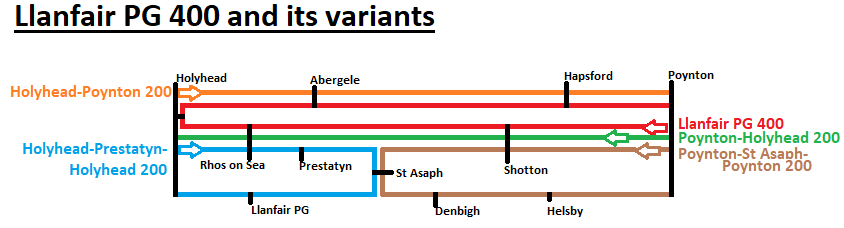
| 77km: | Shotton |
| 133km: | Rhos on sea |
| 204km: | Holyhead |
| 294km: | Abergele |
| 356km: | Hapsford |
| 415km: | Poynton |